


Please use this identifier to cite or link to this item:
http://hdl.handle.net/2307/5722| Title: | Map of Somalia coast circa 1750 | Discipline: | Soggettario Centro Studi Somalo::ARCHEOLOGIA E STORIA::Coloniale Xoghayaha Xarunta Cilmibaarista Soomaaliyeed::Arkiyooloji iyo taariikh::xillaga gumaysiga Center for Somali Studies List of Subjects::Archaeology and history::colonial |
Keywords: | mappa khariiddad maps |
Issue Date: | 8-Feb-2017 | Call Number: | Originale conservato presso il Centro studi Somali : http://host.uniroma3.it/centri/CentroStudiSomali/index.php | Image Subject: | Mappa della costa dell'Africa orientale del 1750 circa. khariddadii xeebta Afrikada Bari oo la sameeyey 1750. Maps of Eastern Africa coast of 1750 circa. Link: https://mogadishuimages.wordpress.com/2011/10/25/map-of-somalia-coast-circa-1750/ |
Description: | Immagine tratta dal sito "Mogadishu: Images from the past" (https://mogadishuimages.wordpress.com/) e inclusa nell'Archivio Somalia con il consenso del curatore della collezione Rick Davies. Sawir laga soo qaatay mareegta "Mogadishu: Images from the past" (https://mogadishuimages.wordpress.com/) oo lagu biiriyay Kayda Soomaaliya, kaddib markii laga helay ruqsad milkiilaha sawwirrada, Rick Davies. Image taken from the website "Mogadishu: Images from the past" (https://mogadishuimages.wordpress.com/) and included in the Somali Archive with the permission of the owner of the collection, Mr. Davies. |
URI: | http://hdl.handle.net/2307/5722 |
| Appears in Collections: | Immagini - Sawirro - Images |
Files in This Item:
| File | Description | Size | Format | |
|---|---|---|---|---|
| somalia-1750-map1.jpg | 393.21 kB | JPEG | 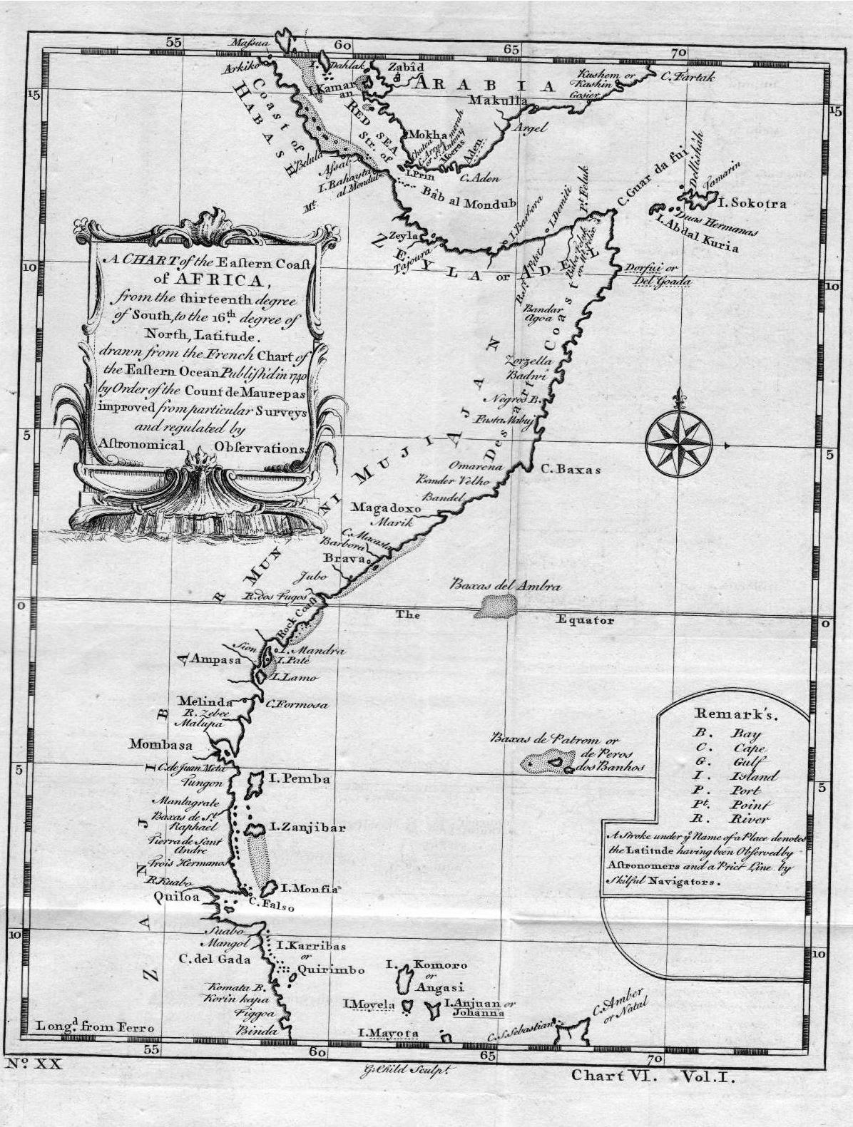 View/Open |
Page view(s)
460
Last Week
2
2
Last month
3
3
checked on Jul 11, 2026
Download(s)
191
checked on Jul 11, 2026

Google ScholarTM
Check
This item is licensed under a Creative Commons License
