


Please use this identifier to cite or link to this item:
http://hdl.handle.net/2307/5472| Title: | Somaliland Protectorate, 1948 | Discipline: | Soggettario Centro Studi Somalo::GEOGRAFIA::Cartografia Xoghayaha Xarunta Cilmibaarista Soomaaliyeed::Juqraafi::khariiqad samayn Center for Somali Studies List of Subjects::Geography::cartography |
Keywords: | mappa khariidad map |
Issue Date: | 28-Nov-2016 | Date of creation: | 1948 | Type: | Image | Call Number: | Originale conservato presso il Centro studi Somali : http://host.uniroma3.it/centri/CentroStudiSomali/index.php | Image Subject: | Mappa del Protettorato britannico, 1948. Khariiddada Somaliland, qaybta Ingiriiska gumaystay, 1948. Map of British Somaliland Protectorate, 1948. Link: https://mogadishuimages.wordpress.com/2014/01/03/somaliland-protectorate-1948/ |
Description: | Immagine tratta dal sito "Mogadishu: Images from the past" (https://mogadishuimages.wordpress.com/) e inclusa nell'Archivio Somalia con il consenso del curatore della collezione Rick Davies. Sawir laga soo qaatay mareegta "Mogadishu: Images from the past" (https://mogadishuimages.wordpress.com/), waxaana lagu biiriyay Kaydka Soomaaliya, kaddib markii oggolaasho laga helay qofka diyaariyay oo ah Rick Davies. Image taken from the website "Mogadishu: Images from the past" (https://mogadishuimages.wordpress.com/) and included in the Somali Archive with the permission of the owner of the collection, Mr. Davies. |
URI: | http://hdl.handle.net/2307/5472 |
| Appears in Collections: | Immagini - Sawirro - Images |
Files in This Item:
| File | Description | Size | Format | |
|---|---|---|---|---|
| 049_somaliland-1948.jpg | 168.57 kB | JPEG | 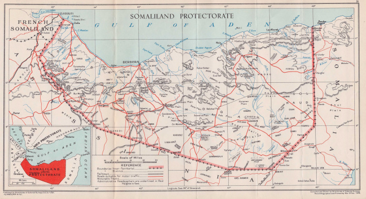 View/Open |
Page view(s)
327
Last Week
0
0
Last month
1
1
checked on Jul 11, 2026
Download(s)
115
checked on Jul 11, 2026

Google ScholarTM
Check
This item is licensed under a Creative Commons License
