


Please use this identifier to cite or link to this item:
http://hdl.handle.net/2307/5468| DC Field | Value | Language |
|---|---|---|
| dc.contributor.author | Morden, Robert | - |
| dc.date.accessioned | 2016-11-21T09:09:19Z | - |
| dc.date.available | 2016-11-21T09:09:19Z | - |
| dc.date.created | 1688 | - |
| dc.date.issued | 1688 | - |
| dc.identifier.uri | http://hdl.handle.net/2307/5468 | - |
| dc.description | Image taken from the website "Mogadishu: Images from the past" (https://mogadishuimages.wordpress.com/) and included in the Somali Archive with the permission of the owner of the collection, Mr. Davies. | it_IT |
| dc.description | Sawir laga soo qaatay mareegta "Mogadishu: Images from the past" (https://mogadishuimages.wordpress.com/) waxaana lagu biiriyay Kaydka Soomaaliya, kaddib markii laga helay ruqsad qofka ururiyay dokumentooyinka Rick Davies. | it_IT |
| dc.description | Immagine tratta dal sito "Mogadishu: Images from the past" (https://mogadishuimages.wordpress.com/) e inclusa nell'Archivio Somalia con il consenso del curatore della collezione Rick Davies. | it_IT |
| dc.subject | maps | it_IT |
| dc.subject | khariiddado | it_IT |
| dc.subject | mappa | it_IT |
| dc.title | Somali coast, circa 1688 | it_IT |
| dc.type | Image | it_IT |
| dc.relation.altloc | Originale conservato presso il Centro studi Somali : http://host.uniroma3.it/centri/CentroStudiSomali/index.php | |
| dc.subject.studisomali | Center for Somali Studies List of Subjects::Geography::cartography | it_IT |
| dc.subject.studisomali | Xoghayaha Xarunta Cilmibaarista Soomaaliyeed::Juqraafi::khariiqad samayn | it_IT |
| dc.subject.studisomali | Soggettario Centro Studi Somalo::GEOGRAFIA::Cartografia | it_IT |
| dc.description.subject | Rare early English map of the East African Coastline, perhaps the earliest obtainable English map of the region. | it_IT |
| dc.description.subject | Khariiddad qaddiim ah oo ku saabsan xeebta Afrikada bari, waxaa dhici karti in ay tahay khariiddadii ugu qaddiinsan ee ay sameeyeen Ingiriiska. | it_IT |
| dc.description.subject | Rara e antica mappa inglese della Costa Orientale Africana, forse la più antica mappa inglese della regione a disposizione. | it_IT |
| dc.description.subject | Link: https://mogadishuimages.wordpress.com/2014/01/03/somali-coast-circa-1700s/ | it_IT |
| item.grantfulltext | open | - |
| item.fulltext | With Fulltext | - |
| Appears in Collections: | Immagini - Sawirro - Images | |
Files in This Item:
| File | Description | Size | Format | |
|---|---|---|---|---|
| 046b_zang2.jpg | 105.58 kB | JPEG |  View/Open | |
| 046b_zang2.jpg | 105.58 kB | JPEG | 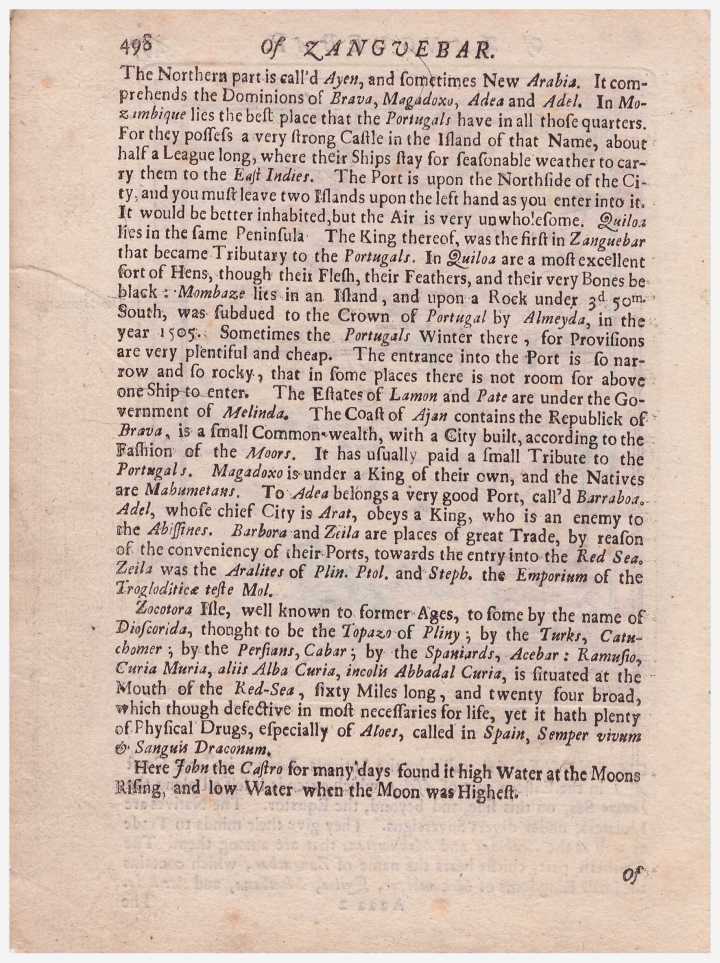 View/Open |
Page view(s)
1,379
Last Week
0
0
Last month
3
3
checked on Aug 1, 2026
Download(s)
657
checked on Aug 1, 2026

Google ScholarTM
Check
This item is licensed under a Creative Commons License
