


Utilizza questo identificativo per citare o creare un link a questo documento:
http://hdl.handle.net/2307/5435| Campo DC | Valore | Lingua |
|---|---|---|
| dc.date.accessioned | 2016-11-14T08:49:35Z | - |
| dc.date.available | 2016-11-14T08:49:35Z | - |
| dc.date.issued | 2016-11-14 | - |
| dc.identifier.uri | http://hdl.handle.net/2307/5435 | - |
| dc.description | Image taken from the website "Mogadishu: Images from the past" (https://mogadishuimages.wordpress.com/) and included in the Somali Archive with the permission of the owner of the collection, Mr. Davies. | it_IT |
| dc.description | Sawirkan waxaa laga soo qaatay website-ka "Mogadishu(https://mogadishuimages.wordpress.com/), waxaana lagu biiriyay Kaydka Soomaaliya, kaddib markii ruqsad laga helaay ninka soo ururiyay sawirrada, Mr. Davies. | it_IT |
| dc.description | Immagine tratta dal sito "Mogadishu: Images from the past" (https://mogadishuimages.wordpress.com/) e inclusa nell'Archivio Somalia con il consenso del curatore della collezione Rick Davies. | it_IT |
| dc.subject | Horn of Africa map | it_IT |
| dc.subject | modern age | it_IT |
| dc.subject | khariiddad Geeska Afrika | it_IT |
| dc.subject | xilliga casriga ah | it_IT |
| dc.subject | Mappa del Corno d'Africa | it_IT |
| dc.subject | Età moderna | it_IT |
| dc.title | 1750 French map of the north east of Africa | it_IT |
| dc.type | Image | it_IT |
| dc.relation.altloc | Originale conservato presso il Centro studi Somali : http://host.uniroma3.it/centri/CentroStudiSomali/index.php | |
| dc.subject.studisomali | Center for Somali Studies List of Subjects::Archaeology and history::pre-colonial | it_IT |
| dc.subject.studisomali | Xoghayaha Xarunta Cilmibaarista Soomaaliyeed::Arkiyooloji iyo taariikh::xilliga gumaysiga ka hor | it_IT |
| dc.subject.studisomali | Soggettario Centro Studi Somalo::ARCHEOLOGIA E STORIA::Pre-coloniale | it_IT |
| dc.description.subject | Many of the features on this map seem largely imaginary. Some of the names on the Somalia coast are of trading ports known in antiquity but no long in existence in 1750 e.g. | it_IT |
| dc.description.subject | Wax badan oo ka dhex muuqda khariidadan waxay u egyihiin wax iska mala'awaal ah. Sida magacyada qaarkood ee ku qoran dhanka xeebaha Soomaaliya waxay yihiin magacyo dekado waayadii hore la yiqiin, laakiin aan jirin xilliga la sameeyey khariiddadan oo ah 1750. | it_IT |
| dc.description.subject | Molte delle indicazioni presenti in questa mappa sembrano immaginarie. Alcuni nomi segnati sulle coste della Somalia, ad esempio, si riferiscono a dei porti conosciuti nell'antichità ma che non esistono più nel 1750 - epoca a cui risale la mappa. | it_IT |
| dc.description.subject | https://mogadishuimages.wordpress.com/2014/11/04/1750-french-map-of-the-north-east-of-africa/ | it_IT |
| item.fulltext | With Fulltext | - |
| item.grantfulltext | open | - |
| È visualizzato nelle collezioni: | Immagini - Sawirro - Images | |
File in questo documento:
| File | Descrizione | Dimensioni | Formato | |
|---|---|---|---|---|
| 031_1750 French map of the north east of Africa.jpg | 159.21 kB | JPEG | 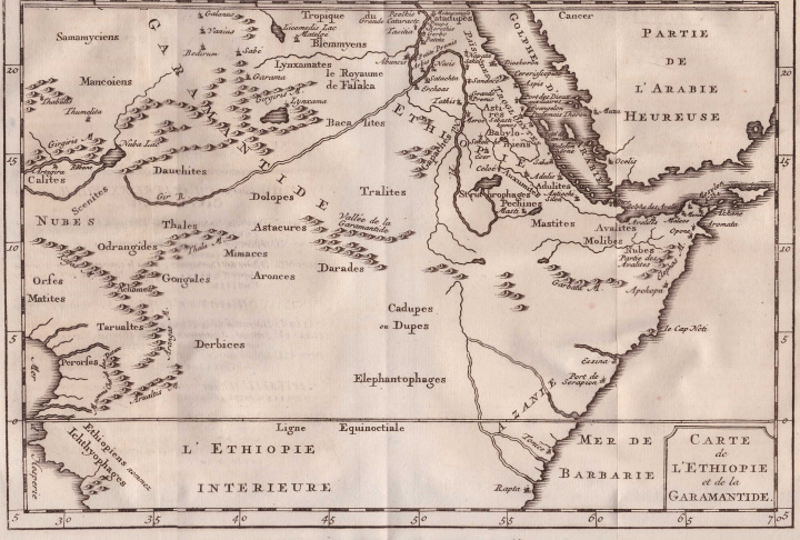 Visualizza/apri | |
| 032_somalia-1750-map1.jpg | 129.47 kB | JPEG | 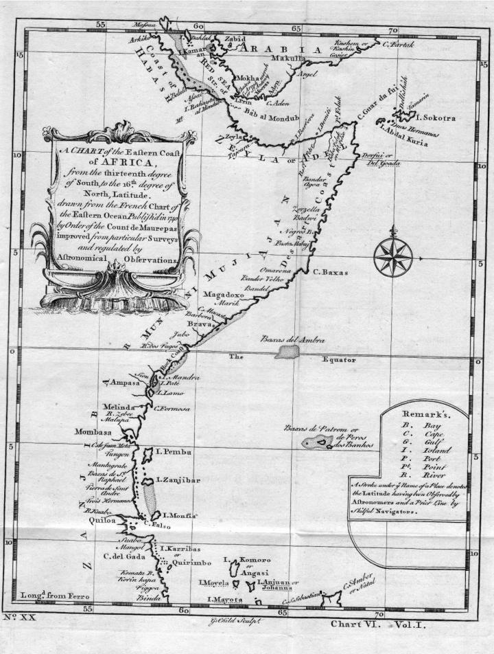 Visualizza/apri |
Page view(s)
812
Last Week
0
0
Last month
19
19
checked on 12-lug-2026
Download(s)
189
checked on 12-lug-2026

Google ScholarTM
Check
Questo documento è distribuito in accordo con Licenza Creative Commons
